
Easy To Read: Tennessee State Map
Product Description
Easy To Read: Tennessee State Map
Rand McNally's Easy To Read State Folded Map is a must-have for anyone traveling in and around Tennessee, offering unbeatable accuracy and reliability at a great price. Our trusted cartography shows all Interstate, U.S., state, and county highways, along with clearly indicated parks, points of interest, airports, county boundaries, and streets.<br>The easy-to-use legend and detailed index make for quick and easy location of destinations. You'll see why Rand McNally folded maps have been the trusted standard for years.<br><br> Regularly updated, full-color maps<br> 63% larger map with a bigger type size than the Rand McNally Folded Map<br> Clearly labeled Interstate, U.S., state, and county highways<br> Indications of parks, points of interest, airports, county boundaries, and more<br> Mileage and driving times map<br> Detailed index<br> Convenient folded size<br><br>Detailed maps of: Chattanooga, Clarksville, Cumberland Gap National Historical Park, Gatlinburg/Pigeon Forge, Great Smoky Mountains National Park, Jackson, Knoxville, Memphis & Vicinity, Nashville & Vicinity, Tri-Cities: Johnson City/Kingsport/ Bristol
Technical Specifications
You might also like
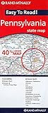
Rand Mcnally Easy To Read: Pennsylvania State Map

Rand McNally Easy To Read: New Hampshire, Vermont

Massachusetts State Map

Rand McNally Easy To Read: Connecticut, Rhode Island

Rand McNally Folded Map: Virginia

Rand McNally Easy to Read! Alabama State Map

Rand McNally Easy To Read: Maine State Map

Rand McNally Easy To Read: Ohio State Map

Easy to Read!: Illinois State Map

Rand McNally Folded Map: North Carolina (Rand McNally State Maps)