
Rand McNally Central United States: Regional Map

Product Description
Rand McNally Central United States: Regional Map
- Used Book in Good Condition
Rand McNally's folded map featuring the Central United States is a must-have for anyone traveling in and around this part of the country, offering unbeatable accuracy and reliability at a great price. Our trusted cartography shows all Interstate, state, and county highways, along with clearly indicated points of interest, airports, county boundaries, and more. <br>You'll see why Rand McNally folded maps have been the trusted standard for years.<br><br> Regularly updated, full-color maps<br> Clearly labeled Interstate, U.S., state, and county highways<br> Detail maps of major cities, a mileage chart, and a Mileages & Driving Times Map<br> Indications of parks, points of interest, airports, county boundaries, and more<br> Easy-to-use legend<br> Detailed index<br> Convenient folded size<br><br>Coverage Area<br><br>States covered: Arkansas, Illinois, Iowa, Kansas, Louisiana, Minnesota, Mississippi, Missouri, Nebraska, North Dakota, Oklahoma, South Dakota, Texas, and Wisconsin<br><br>Product Details<br><br>Measures 9.5" x 4.125" and folds out to 40" x 28".
Technical Specifications
You might also like
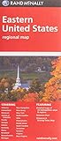
Folded Map: Eastern United States

Folded Map: Western United States

Rand McNally Folded Map: United States

Easy To Read: Montana, Wyoming State (Rand Mcnally Easy to Read!)

Easy To Read: North Dakota, South Dakota (Rand McNally State Maps)

Easy to Read Colorado

Folded Map: New England

Rand McNally 2020 Large Scale Road Atlas
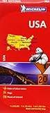
Michelin USA Road Map 761 (Maps/Country (Michelin))

Utah Road Map