
Rand McNally Eastern United States: Regional Map
Product Description
Rand McNally Eastern United States: Regional Map
Rand McNally's folded map featuring the Eastern United States is a must-have for anyone traveling in and around this part of the country, offering unbeatable accuracy and reliability at a great price. Our trusted cartography shows all Interstate, state, and county highways, along with clearly indicated points of interest, airports, county boundaries, and more. <br>You'll see why Rand McNally folded maps have been the trusted standard for years.<br><br> Regularly updated, full-color maps<br> Clearly labeled Interstate, U.S., state, and county highways<br> Detail maps of major cities, a mileage chart, and a Mileages & Driving Times Map<br> Indications of parks, points of interest, airports, county boundaries, and more<br> Easy-to-use legend<br> Detailed index<br> Convenient folded size<br><br>Coverage Area<br><br>Alabama, Connecticut, Delaware, District of Columbia, Florida, Georgia, Indiana, Kentucky, Maine, Maryland, Massachusetts, Michigan, New Hampshire, New Jersey, New York, North Carolina, Ohio, Pennsylvania, Rhode Island, South Carolina, Tennessee<br><br>Product Details<br><br>Measures 9.5" x 4.125" and folds out to 40" x 28".
Technical Specifications
You might also like

Folded Map: Central United States

Folded Map: Western United States

Folded Map: New England

Rand McNally Folded Map: United States

Easy To Read: Delaware, Maryland

Easy To Read: New York State Map (Rand McNally Easy to Read!)

Easy To Read: New Hampshire, Vermont (Rand McNally Easy to Read!)

Michelin USA: Southeast Map 584 (Maps/Regional (Michelin))

Easy To Read: North Carolina (Rand McNally State Maps)
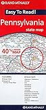
Easy To Read: Pennsylvania State Map (Rand McNally Easy to Read!)