
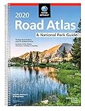
Rand McNally 2020 Large Scale Road Atlas

Product Description
Rand McNally 2020 Large Scale Road Atlas
Give road-weary eyes a break with this spiral-bound Large Scale edition featuring all the accuracy you've come to expect from Rand McNally, only bigger. Updated atlas contains maps of every U.S. state that are 35% larger than the standard atlas version plus over 350 detailed city inset and national park maps and a comprehensive, unabridged index. Road construction and conditions contact information for every state conveniently located on map pages. Contains mileage chart showing distances between 77 North American cities and national parks with driving times map. Tough spiral binding allows the book to lay open easily. Other Features Rand McNally presents five of our favorite national parks big and small, east and west that showcase this country's astonishing beauty, highlight essential visitor information, and offer insightful travel tips. Tell Rand! As much as we work to keep our atlases up to date, conditions change quickly and new construction projects begin frequently. If you know of something we haven't captured in our atlas, let us know at randmcnally.com/tellrand. Tourism websites and phone numbers for every U.S. state and Canadian province on map pages Product Details
Technical Specifications
You might also like
Rand McNally 2020 National Park Atlas & Guide

Rand McNally Folded Map: United States

The 2020 Good Sam Guide Series for the RV & Outdoor Enthusiast

50 States, 5,000 Ideas: Where to Go, When to Go, What to See, What to Do

the Next EXIT 2020

National Geographic Road Atlas 2019: Adventure Edition [United States, Canada, Mexico] (National Geographic Road Atlas: United States, Canada, Mexico: Adventure Edition)

Folded Map: Western United States
Rand McNally 2020 EasyFinder® Midsize Road Atlas

100 Parks, 5,000 Ideas: Where to Go, When to Go, What to See, What to Do

National Geographic Guide to Scenic Highways and Byways, 5th Edition: The 300 Best Drives in the U.S.