
Waterproof Charts 32B British
Product Description
Waterproof Charts 32B British
- Waterproof Charts 32B British
- Virgin Islands standard navigation
- Manufactured in United States
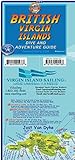
Coverage from St. Johns and Jost Van Dyke east and north to Virgin Gorda and Anegada. Detailed insets for Gorda Sound and for Road Harbor. Large Print coverage of the Sir Francis Drake Channel and Norman, Peter, Salt, Cooper and Ginger Islands. Information from NOAA Charts 25640 and 25641. WGS84-World Mercator Datum. Free Update Service provided by this vendor (proof of purchase required). 25" x 38".
Technical Specifications
You might also like

Cruising the Virgin Islands Planning Map

The 2017-2018 Cruising Guide to the Virgin Islands
British Virgin Islands Adventure & Dive Guide Franko Maps BVI Waterproof Map

Virgin Anchorages

Weems & Plath Marine Navigation Primary Navigation Set

Davis Instruments Navigation Rules Quick Reference Card

Weems & Plath Marine Navigation Parallel Ruler (Aluminum Arms, 15-Inch)

British Virgin Islands Dive Map & Coral Reef Creatures Guide Franko Maps BVI Laminated Fish Card

Davis Instruments Coastwise Piloting Quick Reference Card