
National Geographic United States Wall Map - Explorer - Laminated (32 x 20.25 in) (National Geographic Reference Map)

Product Description
National Geographic United States Wall Map - Explorer - Laminated (32 x 20.25 in) (National Geographic Reference Map)
- Top National Geographic quality
- Current and up-to-date
- Paper Edition
- Ships rolled in a sturdy shipping tube
- 21x30 Poster Size
<p>The United States <i>Explorer</i> map is a classic example of the cartographic excellence National Geographic is known for. This colorful political map clearly shows state boundaries, capitals, major highways, rivers, lakes, and many major cities. Insets show detail of Alaska and Hawaii. The color palette is vibrant and stunning shaded relief provides additional texture and detail.</p><p>The map is encapsulated in heavy-duty 1.6 mil laminate which makes the paper much more durable and resistant to the swelling and shrinking caused by changes in humidity. Laminated maps can be framed without the need for glass, so the fames can be much lighter and less expensive. </p><i><ul><li>Map Scale = 1:6,396,000</li><li>Sheet Size = 32" x 20.25"</li></ul></i>
Technical Specifications
You might also like

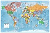
National Geographic: World Explorer Wall Map - Laminated (32 x 20 inches) (National Geographic Reference Map)

ADVANTUS Medium Head Map Tacks, 3/8-Inch Shank, 3/16-Inch Head, Box of 100, Assorted Colors (MTA)

National Geographic: World Decorator Wall Map - Laminated (46 x 30.5 inches) (National Geographic Reference Map)

Yalis Push Pins 600-count Map Tacks Marking Pins 1/8-Inch Plastic Beads Head, 10 Assorted Colors

National Geographic: World Classic Wall Map - Laminated (43.5 x 30.5 inches) (National Geographic Reference Map)

600 PCS Multi-color Push Pins Map tacks ,1/8 inch Round head with Stainless Point, 10 Assorted Colors (Each Color 60 PCS) in reconfigurable container for bulletin board, fabric marking

Swiftmaps 24x36 World Classic Premier Wall Map Poster (Laminated)

US President's Reference Poster

Rand McNally Signature Map of the World, 50 x 32-Inch
24x36 World Classic Elite Wall Map Mural Poster Laminated