
BOSTON Street Map and City Guide

Product Description
BOSTON Street Map and City Guide
<p><b>MAP NEIGHBORHOOD COVERAGE:</b></p> <p>The North End, The South End, South Boston with the convention center, Cambridge including Harvard Square, The Boston Commons, Beacon Hill and the Back Bay.</p><br /> <p><b>ON THE MAP:</b></p> <p> Museum Highlights & Historical Landmarks</p> <p> Restaurants, Cafés & Entertainment</p> <p> Independent, Local, and Luxury Shopping</p> <p> Centrally Located Hotels</p> <p> Theatre, Sports, and Performance Spaces</p> <p> Metro Stops are shown right on the map!</p> <p> Parks, Gardens & Open Spaces</p> <p> Accordianfold map: Open: 24 x 9 in / 61 x 23 cm / Closed: 4 x 9 in / 10 x 23 cm</p><br/> <p><b>BOSTON HIGHLIGHTS:</b></p> <p>Attractions to see on the Red Map Boston include museums such as the <b>Museum of Fine Arts, Isabella Stewart Gardner Museum, the ICA</b>, plus the university museums of <b>Harvard and MIT</b>. For a walk in the park there is the <b>Boston Commons</b>, which is near to the designer shops on <b>Newbury Street, Boylston Street</b> and <b>Copley Plaza</b>. Talk of revolution? Then be sure to see <b>Paul Revere's House,</b> the <b>Old North Church</b> and walk the <b>Black Heritage and Boston Freedom Trails</b>.</p>
Technical Specifications
You might also like

Bostonian's Boston Map
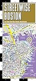
Streetwise Boston Map - Laminated City Center Street Map of Boston, Massachusetts (Michelin Streetwise Maps)
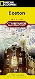
Boston (National Geographic Destination City Map)

DK Eyewitness Travel Guide Boston

Rand McNally Folded Map: Greater Boston Eastern Massachusetts Regional Map

Fodor's Boston (Full-color Travel Guide)

Red Maps PHILADELPHIA Street Map and City Guide

Top 10 Boston (Pocket Travel Guide)