
Rand McNally Easy to Read: New York State Map
Product Description
Rand McNally Easy to Read: New York State Map
- Regularly updated, full-color maps
- 48% larger map with a bigger type size than the Rand McNally Folded Map
- Clearly labeled Interstate, U.S., state, and county highways
- Indications of county boundaries, schools, shopping malls, parks, golf courses, hospitals, airports, and points of interest
- Mileage and driving times map
- Detailed index
- Copyright 2023
- Coverage Area Detailed maps of: Albany/Schenectady, Binghamton, Buffalo/Niagara Falls, Central Long Island, Elmira, New York City & Vicinity, Manhattan, Rochester, Syracuse, Utica
Technical Specifications
You might also like

Special Delivery
—

Olympic Dreams (High Hurdles #1)
—

Rope Net Climbing Net for Kids Adult Playground Tree Nylon Play Giant Mesh Heavy Duty Cargo Toddler Climbing Climb Net Netting Nets for Adults Outdoor Swing Set Swingset Ladder Toys(12mm-10cm,1X3m/3.3
—
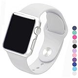
Piwjo Silicone Apple Watch Band and Replacement Iwatch Bands Series 1, Series 2,Series 3(White, 38mm S/M)
—

WALIKI Hopper Ball for Adults | 29" Purple Jumping Toy | Hippity Hop | Fun Outdoor Game for Parties & Family Activities
—

ZRM&E 100pcs Stainless Steel Cable Ties, 15.8 Inches (40CM) Self-Locking Cable Zip Ties High Loop Tensile Strength Durability
—

Freeze Girls 2-6X Doc McStuffins Toddler Hoodie, White Multi, 3T
—

Saving Private Ryan: Music From The Original Motion Picture Soundtrack
—