
Rand McNally Easy to Read: California State Map
Product Description
Rand McNally Easy to Read: California State Map
- Regularly updated, full-color maps
- Clearly labeled Interstate, U.S., state, and county highways
- 40% larger map with a bigger type size than the Rand McNally Folded Map
- Indications of county boundaries, schools, shopping malls, parks, golf courses, hospitals, airports, and points of interest
- Mileage and driving times map
- Detailed index
- Copyright 2023
- Coverage Area Detailed maps of: Bakersfield, Fresno, Joshua Tree National Park, Kings Canyon Natl Park & Sequoia Natl Park, Lake Tahoe Region, Lancaster/Palmdale, Los Angeles, Modesto, Monterey/Salinas, Oceanside, Oxnard/Ventura, Palm Springs, Sacramento, San Diego
Technical Specifications
You might also like
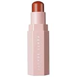
Fenty Beauty by Rihanna Match Stix Corrector Skinstick Pumpkin
—
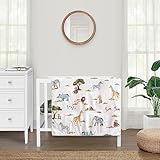
Sweet Jojo Designs Jungle Animals Boy Girl Unisex Baby Mini Crib Bedding Set Infant Nursery Room Newborn Blanket and Portable Pack n Play Sheets 3p Dark Hunter Green Safari Elephant Giraffe Lion Zebra
—

Terramoza Ceramic Bathroom Accessory Set, 5 Pcs - Soap Dispenser 16 Oz, Toothbrush Cup, Toothbrush Holder, Soap Dish, Candle Holder - Beige, Boho Bathroom Sink Decor, Modern Countertop Accessories
—
Alipis Refillable Baby Wipes Dispenser Box with Non-Slip Base Portable Wet Tissue Holder for Nursery Bedroom Kitchen and Travel 6.69X4.13X2.36 Inches
—

BOBCOO Short Blonde Pixie Cut Wigs For Black Women Short Wigs With Bangs Short Wigs For Black Women Layered Wigs(Blonde)
—

HWC Trading Michael Jackson Complete Collection 16 x 12 inch Gifts Printed Signed Autograph Picture for Music Memorabilia Fans - 16" x 12" Framed
—
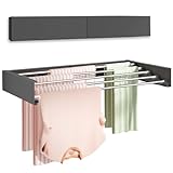
Vikaqi Wall Mounted Clothes Drying Rack 32", Foldable Wall Mount Laundry Rack Folding Indoor, Drying Rack Clothing Collapsible, Hidden Space Saver with Wall Template, 5 Rods, Black
—
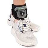
JOMECA Adjustable Drop Foot Brace with Rotary Knob AFO Ankle Foot Orthosis for Dorsiflexion Support Foot Drop Prevention Foot Drop Brace for Walking Shoe Eyelet Hook Attachment (1 Pack)
—