Easy To Read: Georgia State Map (Rand Mcnally Easy to Read!)

Product Description
Easy To Read: Georgia State Map (Rand Mcnally Easy to Read!)
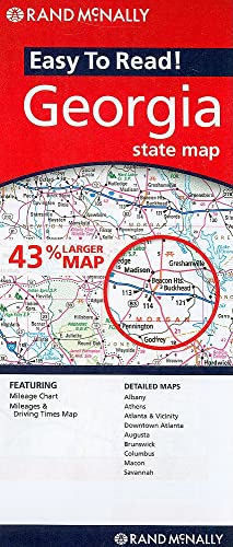
Rand McNally's Easy To Read State Folded Map is a must-have for anyone traveling in and around Georgia, offering unbeatable accuracy and reliability at a great price. Our trusted cartography shows all Interstate, U.S., state, and county highways, along with clearly indicated parks, points of interest, airports, county boundaries, and streets. <br>The easy-to-use legend and detailed index make for quick and easy location of destinations. You'll see why Rand McNally folded maps have been the trusted standard for years.<br><br> Regularly updated, full-color maps<br> 43% larger map with a bigger type size than the Rand McNally Folded Map<br> Clearly labeled Interstate, U.S., state, and county highways<br> Indications of parks, points of interest, airports, county boundaries, and more<br> Mileage and driving times map<br> Detailed index<br> Convenient folded size<br><br>Coverage Area<br><br>Detailed maps of: Albany, Athens, Atlanta & Vicinity, Downtown Atlanta, Augusta, Brunswick, Columbus, Macon, Savannah
Technical Specifications
You might also like

Easy To Read: South Carolina

Easy To Read: North Carolina (Rand McNally State Maps)

Easy To Read: Florida State Map (Rand Mcnally Easy to Read!)

Easy To Fold: Tennessee (Easyfinder Maps)

Easy To Read: Virginia

Rand McNally Folded Map: Atlanta Street Map

Rand McNally Easy To Read: Alaska State Folded Map

Easy To Read: New York State Map (Rand McNally Easy to Read!)

Folded Map: Atlanta Regional Map