
Pacific Crest Trail Pocket Maps - Southern California

Product Description
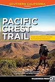
Pacific Crest Trail Pocket Maps - Southern California
<p><em>Southern California</em><br>8th Edition - October 25, 2017 - Major Updates for 2018</p> <p>The Pacific Crest Trail Pocket Map Series is a current, complete and concise set of topographic maps created with <em>digitized base maps</em> covering every step of the 2,650 mile trail from Mexico to Canada. These are not 40 year old scanned USGS topographic maps.</p> <p> <strong>Features:</strong><br> + Accurate trail trace<br> + 363 full color, digitized topographic maps<br> + Highly detailed elevation chart on each map<br> + Seamless, with uniform style, colors, fonts and unit of measure.<br> + Beautiful 3D hill shading<br> + Decimal degrees latitude/longitude and UTM Grids<br> + 10 beautiful land cover shades enhanced with textures. Evergreen, diciduous, mixed, scrub, wetlands and more<br> + All feature names from October 2017, USGS Geographic Names Information System (GNIS)<br> + Meta data for each section and month, precip, high/low temp, snow cover. Nearby lakes, rivers, roads, etc<br> + Section overview map with elevation profile for each section<br> + 1:38500 scale, 6" x 9" (15.2cm x 22.9cm) format for easy pack stowage<br> + Accumulated trail mileage every mile<br> + Resupply locations within 90 miles of map center<br> + Data book information printed at each locale on the maps<br> + Over 2,400 points of interest resupply, water, trail junctions, camp sites<br> + Much more detail than possible on any smart phone app. Printed maps don't require batteries! </p> <p>Part of a 3 volume set, these 6" x 9" full color topographic maps are designed to stow easily into your pack, without sacrificing the detail required by a hiker in the back country.</p> <p>All 3 Pacific Crest Trail Pocket Maps volumes are: <strong>Southern California, Northern California and Oregon & Washington.</strong></p>
Technical Specifications
You might also like

Pacific Crest Trail Pocket Maps - Northern California

Pacific Crest Trail Pocket Maps - Oregon & Washington

Pacific Crest Trail Data Book: Mileages, Landmarks, Facilities, Resupply Data, and Essential Trail Information for the Entire Pacific Crest Trail, from Mexico to Canada

National Geographic: Pacific Crest Trail Wall Map in gift box Wall Map (18 x 48 inches) (National Geographic Reference Map)

Hiking the Pacific Crest Trail: Southern California: Section Hiking from Campo to Tuolumne Meadows

BearVault BV500 Bear Resistant Food Canister | For Extended Multi-Day Hikes, Backpacking, Hunting, Fishing, Kayak and Canoe Trips | Large, Lightweight, Crush Resistant Outdoor Food Protection | Lockin

Pacific Crest Trials: A Psychological and Emotional Guide to Successfully Thru-Hiking the Pacific Crest Trail
Pacific Crest Trail: Southern California
TheTentLab New Improved Deuce(R) Ultralight Backpacking Potty Trowel - Now in 3 Sizes

Pocket PCT: Complete Data and Town Guide