
Ohio Atlas & Gazetteer
Product Description
Ohio Atlas & Gazetteer
- Includes back roads, elevation contours, recreational areas, etc.
- Paperback for easy carry and storage
- Easy to use and read
Wouldn't it be nice to always have exactly the right kind of map, whatever your needs may be? You will, with the uniquely versatile DeLorme Atlas & Gazetteer Series. These topographic atlases cover individual states with the most comprehensive detail available, including back roads, backwater lakes and streams, boat ramps, forests, wetlands, trailheads, campgrounds, public lands, prime hunting and fishing spots, and countless landmarks and points of interest. You'll also find a wealth of information on everything from family outings to wilderness adventures. The Atlas & Gazetteer is ideal for outdoor recreation, business travel, home or office reference, and countless other uses.<br><br><br>Ohio Gazetteer categories<br>» Campgrounds <br>» Family Outings <br>» Fishing <br>» Hunting <br>» Outdoor Adventures <br>» Recreation Areas <br>» Unique Natural Features<br><br><br>Suggested Uses<br>» In-vehicle for everyday reference<br>» Exploring back roads<br>» Outdoor recreation preparation and navigation<br>» Business travel<br>» Planning vacations and leisure activities<br>» Armchair journeys
Technical Specifications
You might also like

Indiana Atlas & Gazetteer

Kentucky Atlas & Gazetteer
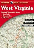
West Virginia Atlas & Gazetteer

Michigan Atlas & Gazetteer (Delorme Michigan Atlas and Gazeteer)

Illinois Atlas and Gazetteer

Pennsylvania Atlas and Gazetteer

DeLorme® Pennsylvania Atlas & Gazetteer (Pennsylvania Atlas and Gazetteer)

Virginia Atlas & Gazetteer

Tennessee Atlas & Gazetteer

New York Atlas and Gazetteer