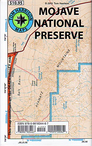
Mojave National Preserve Recreation Map (Tom Harrison Maps)
Product Description
Mojave National Preserve Recreation Map (Tom Harrison Maps)
<b>Mojave National Preserve</b> is one of the newest National Preservation Areas, located South of Hwy 15 and North of Hwy 40 in Southern California. A frequently visit but due to its vast territory, rarely crowded.This map is GPS compatible, with a complete UTM Grid, printed in waterproof and tear resistant material.Beautifully composed over original USDS topographical information, enhased with shade relief and precise information about trails and existing roads.Includes:Cima Dome, Mojave Road, Mid Hills, Hole-in-the Wall, Providence Mountains, New York Mountains, Kelso Dunes, Weethump Joshua Tree Wilderness.Scale 1:190080 (1 inch represents 3 miles). Contour lines interval representing 200 feet. Designed and published by Tom Harrison Maps.
Technical Specifications
You might also like

Mojave National Preserve (National Geographic Trails Illustrated Map)
—

Mojave Road Guide - An Adventure Through Time (Mojave Road Guide)
—

Death Valley National Park Recreation Map (Tom Harrison Maps)
—

Hiking the Mojave Desert: The Natural and Cultural Heritage of Mojave National Preserve
—

California Desert Byways: 68 of California's Best Backcountry Drives
—