
Red Maps LONDON Street Map and City Guide
Product Description
Red Maps LONDON Street Map and City Guide
<b>MAP NEIGHBORHOOD COVERAGE:</b> <p>Hyde Park, Notting Hill, Paddington, Marylebone, Mayfair, Soho, Bloomsbury, The City Business District, Shoreditch, Southwark, Knightsbridge, Belgravia, Chelsea, Whitehall, and Waterloo. There is also an additional area map for Queen Elizabeth II Olympic Park, Greenwich and Canary Wharf.</p><br /> <p><b>ON THE MAP:</b></p> <p>- Museum Highlights & Historical Landmarks</p> <p>- Independent, Local, and Luxury Shopping</p> <p>- Centrally Located Hotels</p> <p>- Theatre, Sports, and Performance Spaces</p> <p>- Metro Stops are shown right on the map!</p> <p>- Parks, Gardens & Open Spaces</p> <p>- Accordian-fold map: Open: 24 x 9 in / 61 x 23 cm / Closed: 4 x 9 in / 10 x 23 cm</p><br /> <p><b>LONDON HIGHLIGHTS:</b></p><p> Attractions to see on the Red Map London include <b>Kensington Palace, Big Ben, Westminster Abbey, Buckingham Palace, St James's Park, Tower of London, Covent Garden Opera House, the Imperial War Museum, The Tate</b> and <b>Tate Modern</b>, <b>The V&A</b>, and <b>The British Museum</b>. Where to shop in London is entertaining, so the Red Map provides you with <b>over 300 designer boutiques and shops</b> on <b>Bond Street, Sloane Street, Jermyn Street</b> and <b>Savile Row</b>.</p>
Technical Specifications
You might also like

Red Maps PARIS Street Map and City Guide

StreetSmart London Map by VanDam - City Center Street Map of London, England - Laminated folding pocket size city travel and Tube map with all museums, attractions, hotels and sights; 2020 Edition
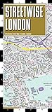
Streetwise London Map - Laminated City Center Street Map of London, England (Michelin Streetwise Maps)

Red Maps ROME Street Map and City Guide

Rick Steves London 2019

Amsterdam Map and City Guide

Barcelona Map and City Guide

Rick Steves London 2018

Madrid & Sevilla Street Map and City Guide