
Humminbird 600017-5 LakeMaster Great Plains V6 Electronic Chart
Product Description
Humminbird 600017-5 LakeMaster Great Plains V6 Electronic Chart
- Maximize every moment of fishing when you upgrade to the unrivaled accuracy and detail of Humminbird LakeMaster mapping, which features easy-to-read contours, highlighted depth ranges, and scrollable lake lists.
- This Great Plains Edition, Version 6 boasts more than 400 high-definition lakes and over 500 total lakes from NE, KS, MO, IA, and IL, with 160 new or updated lakes since the prior version.
- Easy-to-see shading highlights shallow-water areas within an adjustable range up to 30 feet, and depth contours and shorelines can be synchronized with the actual water levels of lakes, reservoirs, and rivers.
- LakeMaster digital maps can be used with Minn Kota i-Pilot Link (sold separately), allowing you to follow a selected depth contour line to deliver precise, automatic boat control.
- LakeMaster digital maps come on a Micro SD card (with included SD card adapter) that's compatible with all GPS-equipped HELIX, SOLIX, ONIX, and ION Series models and select 600-1100 Series models.
The unmatched accuracy and detail of Humminbird LakeMaster give you a serious edge. Patented features include the ability to select and highlight a specific Depth range, the option to shade shallow water ranging from zero to 30 feet, and the power to synchronize Depth Chart contours and shorelines with the current water levels of lakes, reservoirs and rivers. With these exclusive features and more, you'll have everything you need to make your time on the water more productive. Humminbird LakeMaster great plains, version 6 combines many of the best fishing waters for Iowa, Illinois, Kansas, Missouri and Nebraska, all on one map card. Version 6 also brings the groundbreaking technology of follow the contour to your fingertips. When combined with a compatible i-pilot link system, your map card allows your boat to automatically follow a path directly on or offset from any contour, so you can focus on fishing. Version 6 contains 160 new or updated lakes from the previous version, and now has over 500 total lakes with contours, of which more than 400 are now high-definition lakes including:- table rock, Mo - lake of the Ozarks, Mo - three mile, IA - twelve mile, IA - pleasant creek, IA - Cedar, IL - East loon, IL - El Dorado, KS - banner, KS - Bull shoals, Mo- mcconaughy, NE- plus many more! The map card also features other great fishing waters, including: - Keith Sibelius, KS- Wilson, KS - Smithville, Mo - Truman reservoir, Mo - Red rock, IA - Illinois River pools - Mississippi River additionally, the card has outstanding coverage on lake Michigan: - all of lake Michigan (5 ft. & 10 ft. Contours)- green Bay (3 ft. Contours) - big Bay De Noc (3 ft. Contours) - little Bay De Noc (3 ft. Contours) - sturgeon Bay (3 ft. Contours) - little Traverse Bay - grand Traverse Bay.
Technical Specifications
You might also like

Humminbird 5001722 Helix 7 Series Protective Cover

Minn Kota US2 Adaptor Cable for Humminbird 7 Pin

Humminbird 600025-5 Electronic Charts Wisconsin (Dec '16)

Humminbird 780028-1 UC H5 Unit Cover for Helix Series

Humminbird 720073-5 15 foot Ethernet Cable
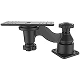
National Products RAM-109H Marine Ram Single Swing Arm Mount System
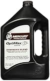
Mercury Optimax /DFI 2-Cycle Outboard Oil 1 Gallon 92-858037K01

MinnKota MK 210D On-Board Battery Charger (2 Banks, 5 amps per bank)