
High Uintas Wilderness Map

Product Description
High Uintas Wilderness Map
- National Geographic High Uintas Wilderness #711 by Utah - TI00000711
<b><p>€ Waterproof € Tear-Resistant € Topographic Map</b></p><p>Explore the alpine vistas, glacier-formed lakes, and Utah€s highest peaks with National Geographic€s Trails Illustrated map of High Uintas Wilderness, Ashley and Wasatch-Cache National Forests. Expertly researched and created in partnership with local land management agencies, this map features key points of interest including Mirror Lake, Kings Peak, Sheep Creek Canyon Geological Area, and portions of the Yellowstone, Uinta, and Duchesne rivers.</p><p>With hundreds of miles of mapped trails, the High Uintas Wilderness map can guide you off the beaten path and back again. A handy chart notes each trailhead, the number of parking spaces at the trailhead, and the facilities available there including horse ramps, corrals, water, toilets, and developed campsites. Snowmobile and ATV trails, as well as four-wheel-drive and high clearance roads are clearly marked. The map base includes contour lines and elevations for summits, passes and many lakes. Helpful information about regulations and wilderness safety is included to help ensure your visit is safe and enjoyable.</p><p>Every Trails Illustrated map is printed on "Backcountry Tough" waterproof, tear-resistant paper. A full UTM grid is printed on the map to aid with GPS navigation.</p><p>Other features found on this map include: Ashley National Forest, High Uintas Wilderness, Kings Peak, Marsh Peak, Mount Lovenia, Uinta National Forest, Wasatch National Forest.</p><i><ul><li>Map Scale = 1:75,000</li><li>Sheet Size = 37.75" x 25.5"</li><li>Folded Size = 4.25" x 9.25"</li></ul></i>
Technical Specifications
Customers who bought this also bought

Canyons of the Escalante [Grand Staircase-Escalante National Monument] (National Geographic Trails Illustrated Map)
View for price
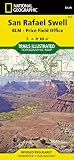
San Rafael Swell [BLM - Price Field Office] (National Geographic Trails Illustrated Map)
View for price

Cloud Peak Wilderness (National Geographic Trails Illustrated Map)
View for price

Taos Area Trails, New Mexico, Publisher - National
View for price
You might also like

Wasatch Front North (National Geographic Trails Illustrated Map)
—

Uinta National Forest, Timpanogos / Lone Peak / Nebo (National Geographic Trails Illustrated Map)
—

Hiking Utah's High Uintas: 99 Day and Overnight Hikes (Regional Hiking Series)
—

Flaming Gorge National Recreation Area (National Geographic Trails Illustrated Map)
—

Ogden, Monte Cristo Range (National Geographic Trails Illustrated Map)
—

Logan, Bear River Range (National Geographic Trails Illustrated Map)
—

60 Hikes Within 60 Miles: Salt Lake City: Including Ogden, Provo, and the Uintas
—
San Rafael Swell [BLM - Price Field Office] (National Geographic Trails Illustrated Map)
—

Hiking the Wasatch: A Hiking and Natural History Guide to the Central Wasatch
—