
Cyprus Map (National Geographic Adventure Map, 3318)

Product Description
Cyprus Map (National Geographic Adventure Map, 3318)
<b>• Waterproof • Tear-Resistant • Travel Map</b></p><p>National Geographic's Cyprus Adventure Map provides global travelers with the perfect combination of detail and perspective in a highly functional travel tool. Cities and towns are clearly indicated and easy to find in the user-friendly index. A road network complete with distances and designations for roads, motorways, expressways, and secondary routes will help you find the route that's right for you. Hundreds of points of interest are highlighted including archeological sites, monuments, castles, mosques, churches, and more, making this map indispensable for travelers seeking to explore the region's rich history. Beaches, yachting harbors, and areas popular for fishing and diving dot Cyprus's extensive coastline. Other recreational destinations such as World Heritage sites, national parks, ski areas, golf courses, sports fields, and riding centers are included as well.</p><p>The front side of the print map shows the western portion of the island. This side details the regions of Paphos, Limassol, Nicosia, Larnaca and Kyrenia. The reverse side of the map shows the eastern part of the island. This side details the regions of Larnaca, Kyrenia and Famagusta. </p><p>A little over a third of the island is occupied by Turkish forces under the self-declared administration of the Turkish Republic of Northern Cyprus. The international community only recognizes the Republic of Cyprus, a member of the European Union, and views this Turkish occupation as illegal under international law. The locations of border crossings, closed borders, airports, harbors, and ferry routes take the guesswork out of travel around the island.</p><p>Every Adventure Map is printed on durable synthetic paper, making them waterproof, tear-resistant and tough — capable of withstanding the rigors of international travel.</p><i><ul><li>Map Scale = 1:165,000</li><li>Sheet Size = 37.75" x 25.5"</li><li>Folded Size = 4.25" x 9.25"</li></ul></i>
Technical Specifications
You might also like

Lonely Planet Cyprus (Travel Guide)

Greece (National Geographic Adventure Map)

Turkey (National Geographic Adventure Map)

DK Eyewitness Travel Guide Cyprus

Hiking & Walking in Cyprus / Kypros Complete Topographic Map Atlas 1:95000 Trekking Paths & Trails Mediterranean World: Trails, Hikes & Walks ... (Travel Guide Hiking Trail Maps for Cyprus)

The Rough Guide to Cyprus (Rough Guides)

Michelin Turkey Map 758 (Maps/Country (Michelin))
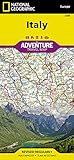
Italy (National Geographic Adventure Map)

Lonely Planet Turkish Phrasebook & Dictionary

Croatia (National Geographic Adventure Map)