
Collins Children’s World Map
Product Description
Collins Children’s World Map
- Detailed World Map: This illustrated world map poster from Collins is a great way to learn about geography in a fun and engaging way
- Lightweight and Durable: With a weight of 96 grams, this world wall map poster is lightweight yet durable, making it easy to hang on your wall
- High-Quality Paper: The smooth finish of the high-quality paper ensures that the map will look great on any wall
- Standard Map Size: With dimensions of 9E+1 cm in length and 3 cm in width, this world wall map poster is the perfect size for any room
<DIV>This highly illustrated pictorial map is designed to take children on a journey of discovery around the countries of the world. The mapping is clear, colorful and highly informative and shows countries and capital cities. Stunning illustrations are used to depict themes such as national emblems, customs, food, birds, animals, buildings and sports to help younger readers gain an understanding of peoples around the world.</DIV>
Technical Specifications
You might also like

Trend Enterprises Alphabet Pocket Flash Cards

The Puppet Company - Knitted Puppet- Dylan
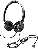
Mpow 071 USB Headset/ 3.5mm Computer Headset with Microphone Noise Cancelling, Lightweight PC Headset Wired Headphones, Business Headset for Skype, Webinar, Cell Phone, Call Center

Creative Teaching Press Upcycle Style Welcome Bulletin Board (7054)
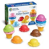
Learning Resources Smart Snacks Rainbow Color Cones, Color Identification, Fine Motor Toy, Ages 2+

Auxiwa Clip on Selfie Ring Light [Rechargeable Battery] with 36 LED for Smart Phone Camera Round Shape, White
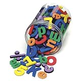
Chenille Kraft 4357 Wonderfoam Magnetic Alphabet Letters, Assorted Colors. 110/Pack (CKC4357)

The Puppet Company - Knitted Puppet -Rainbow

Hanes Men's Short Sleeve Cool DRI T-Shirt UPF 50+, Safety Orange, Large (Pack of 2)