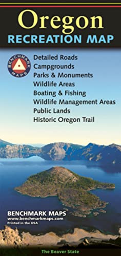
Oregon Recreation Map (Benchmark Maps)
Product ID: 31476400
Condition: New
Payflex: Pay in 4 interest-free payments of R143.75. Learn more
R 575
includes Duties & VAT
Delivery: 10-20 working days
Ships from USA warehouse.
Secure Transaction
VISA
Mastercard
payflex
ozow
Product Description
Oregon Recreation Map (Benchmark Maps)
- Atlases: Every Benchmark atlas is specially designed for enthusiasts of hunting, fishing, camping, boating, hiking, and other outdoor activities. All atlases have Benchmarks exclusive Landscape Maps with large easy-to-read and page overlap, and a useful GPS grid. The categorized Recreation Guide makes planning your next adventure a breeze. The Recreation Maps have public land ownership shown as color tints, and most titles have hunting unit names and boundaries
- Recreational Maps: Benchmarks Recreation Maps were created for outdoor lovers who want the high quality recreation information in our atlases but with the convenience of a traditional folding map. Complete public lands detail and hunting unit boundaries are shown as well as categorized recreation listings.
The Oregon Recreation Map is a folded map version of the Recreation Guide pages within Benchmark's Oregon Road & Recreation Atlas. One side provides a full state map that features Public Lands, extensive highway detail, point-to-point mileages, recreation attractions, campgrounds, parks and wildlife areas, fishing access points, and hunting units (GMU). The reverse side features categorized recreation POI listings with helpful descriptions, current contact information, and map grid references.
Technical Specifications
Country
USA
Brand
Benchmark Maps
Manufacturer
Benchmark Maps
Binding
Map
ItemPartNumber
BE0BENORRM
Model
BE0BENORRM
UnitCount
1
UPCs
767020000242
EANs
9780783499109